Where Superior Hardware Meets Local Mastery
At Waynesboro Ag Drones, we recognize that peak performance requires more than just skill—it demands the most advanced tools available. The Waynesboro region, famous as the "Bird Dog Capital of the World" and home to some of Georgia’s most productive acreage, requires technology that can withstand the dust, heat, and humidity of the Coastal Plain. We don’t simply operate drones; we manage a comprehensive, mission-ready technology ecosystem. Our fleet is refreshed every year to ensure our partners never fall behind the curve of innovation. Whether navigating the dense pine stands of Burke County or the massive, flat expanses of row crops that fuel our local economy, our equipment is specifically chosen to conquer the unique environmental variables of East Georgia.
Partnering with us allows regional enterprises to bypass the massive capital expenditure typically required for high-end aerial operations. The drone industry moves at lightning speed, with hardware cycles rendering equipment obsolete in under two years. By leveraging our services, local businesses enjoy the benefits of a multi-million dollar aviation department without the burden of depreciation, constant maintenance, or specialized pilot training. From 10,000-acre topographic surveys to high-resolution utility inspections, we guarantee your project will be powered by the most secure and efficient flight platforms currently in existence.
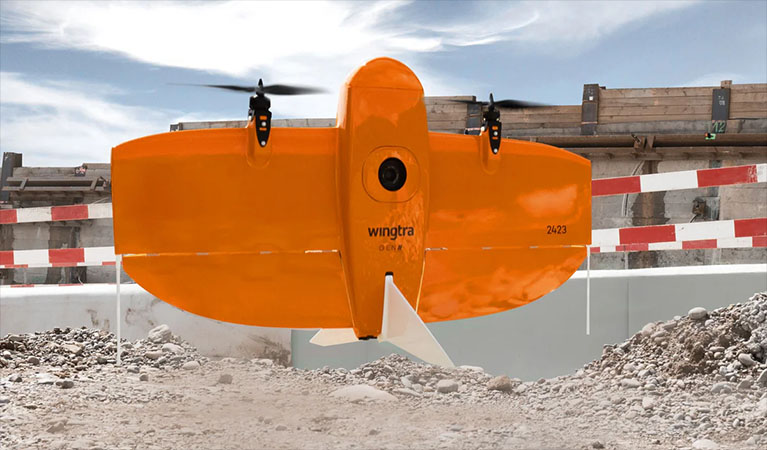
WingtraOne Gen II: Redefining Large-Scale Surveying
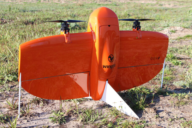
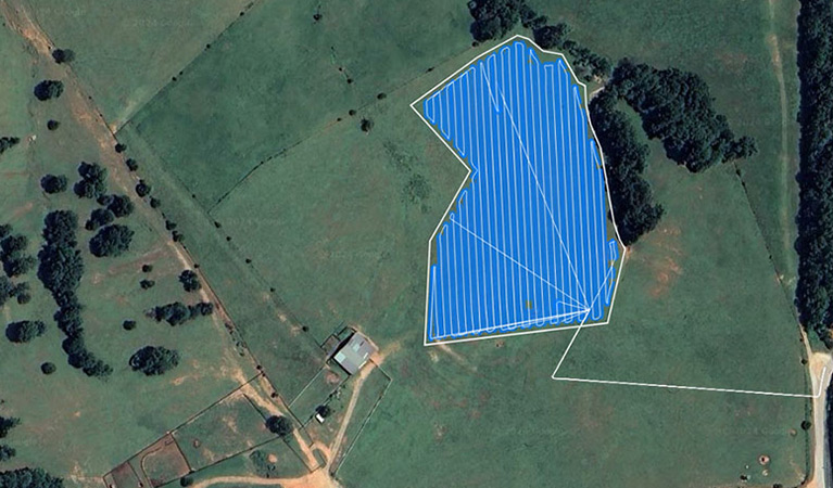
When the mission involves sprawling timber tracts or expansive agricultural boundaries, the WingtraOne Gen II is our primary asset for rapid data collection. In a county as geographically broad as Burke, maximizing flight time is the key to project viability. The WingtraOne is a sophisticated "tailsitter" VTOL (Vertical Take-Off and Landing) craft. It combines the versatility of a helicopter—taking off from narrow logging paths or field edges—with the high-speed, long-distance endurance of a fixed-wing airplane. A single deployment can capture high-resolution data over 700 acres, a feat that would take a standard multi-rotor drone nearly a dozen flights to accomplish.
High speed does not sacrifice microscopic detail. Our WingtraOne Gen II fleet features integrated Post-Processed Kinematic (PPK) GNSS technology. When synced with our proprietary Emlid base stations on-site, we can deliver centimeter-level horizontal and vertical accuracy. For Waynesboro’s civil engineers and land developers, this translates to survey-grade digital twins delivered in record time, eliminating the need for labor-intensive manual ground control points across the sandy reaches of the Coastal Plain.
XAG P150: The Future of Autonomous Crop Protection
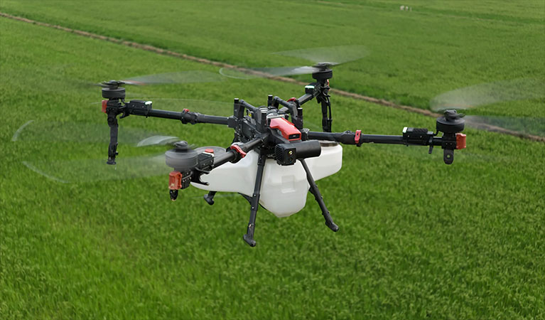
For precision application in the field, we utilize the XAG P150, the pinnacle of heavy-lift agricultural drone technology. In the sweltering, humid environment of East Georgia, the window for effective fungicide or pesticide application is incredibly narrow. The P150 is engineered specifically for the punishing duty cycles of the Southern growing season. Featuring a massive 70-liter payload capacity and state-of-the-art centrifugal atomization, it offers a level of control that traditional hydraulic nozzles cannot match. Our system produces a consistent droplet size, virtually eliminating chemical drift and ensuring every ounce of product reaches its target.
The P150’s true advantage lies in its aerodynamic design. The powerful downward thrust from its rotors creates a massive air vortex that penetrates the thickest crop canopies. This "downwash" effect physically moves the foliage, allowing the spray to coat the undersides of leaves and reach the stalks—critical for combating white mold in peanuts or pests in Burke County cotton. We help growers transition from slow, ground-based rigs that cause crop damage to fast, autonomous aerial applications that protect both the yield and the soil.
| UAS Feature | Benefit to Waynesboro Farmers |
|---|---|
| Variable Rate Application | Apply chemicals only where needed based on high-resolution map data, reducing input costs. |
| Zero Soil Compaction | Effective spraying immediately after heavy rains when ground rigs would cause permanent soil damage or get stuck. |
| Multispectral Imaging | Identifying "hidden" crop stress and nutrient deficiencies before they are visible to the naked eye. |
| Swarm Technology | Multiple drones working a single field in coordination to cover large regional acreage with maximum efficiency. |
Blue UAS: Enterprise-Grade Cybersecurity
As data security becomes a top priority for utility providers and government agencies, the origin and integrity of your drone platform are paramount. Waynesboro Ag Drones is dedicated to maintaining the highest levels of regional data sovereignty. Our surveying operations utilize Blue UAS Certified platforms—a rigorous designation approved by the U.S. Department of Defense. This ensures that every flight meets strict requirements for supply chain transparency and end-to-end data encryption. Whether we are auditing a municipal power grid or mapping sensitive infrastructure near Waynesboro, you can trust that your geospatial assets are shielded from unauthorized access. We provide the peace of mind that consumer-grade hardware simply cannot offer.
Intelligent Processing: Data You Can Act On
The flight is only the beginning of the value chain. The real ROI is generated during our rigorous post-flight processing phase. We utilize the world-class PIX4D software ecosystem to synthesize raw sensor data. This includes PIX4Dmatic for high-precision industrial photogrammetry and PIX4Dfields for real-time agricultural health assessments. Our specialists convert terabytes of imagery into high-fidelity 3D models, orthomosaics, and multispectral maps. We deliver final outputs in the exact CAD and GIS formats used by your professional teams, ensuring that our aerial insights integrate flawlessly into your existing decision-making framework.
Integrated Payload Tech
MAP61 / RGB61
Full-frame Sony sensors delivering unparalleled resolution for 3D reconstruction and precision mapping.
Riegl miniVUX LiDAR
Specialized laser scanning that pierces the Georgia pine canopy to reveal the hidden topography below.
MicaSense RedEdge-P
Five-band multispectral sensing plus panchromatic sharpening for the most detailed crop health analytics available.
Local Readiness
Our Waynesboro operations center is equipped with redundant systems and a deep parts inventory. We ensure zero downtime; if a primary aircraft requires service, a backup is ready for immediate deployment.
Request Technical Brief