Redefining Unmanned Flight in the Bird Dog Capital
Welcome to the Waynesboro hub of Fair Lifts Unmanned Aerial Services. Within the expansive landscapes of Burke County, we recognize that sustaining a robust local economy requires merging cutting-edge robotics with a deep-seated knowledge of our terrain. Waynesboro is more than a regional crossroads; it is the engine room of Georgia’s agricultural output. From the sprawling cotton reaches near Girard to the vital energy infrastructure of the Savannah River corridor, Fair Lifts delivers the technical infrastructure essential for modern enterprises to thrive and expand.
Our philosophy centers on functional intelligence. For too long, aerial technology has been treated as a novelty—yielding stunning imagery but failing to drive bottom-line results. Fair Lifts is rewriting that script. We transition UAVs from high-tech hobbies into indispensable industrial tools. Drawing on a background of stringent aviation safety and professional project management, we ensure every Waynesboro deployment is handled with professional discipline and a granular understanding of the Coastal Plain’s specific requirements.
Cultivating Growth in the Burke County Earth
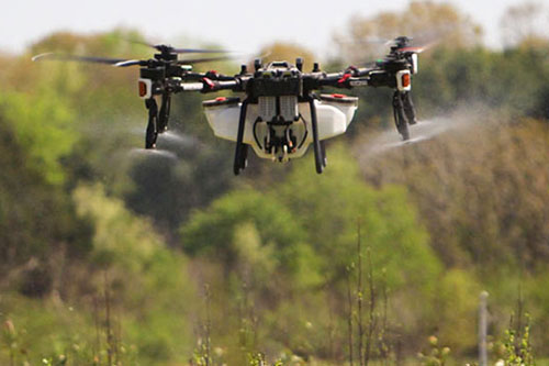
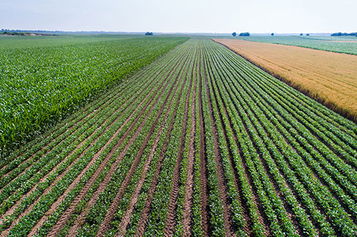
Farming is the lifeblood of Waynesboro. Local producers cultivate some of the nation’s most vital corn, peanut, and cotton harvests. However, the Coastal Plain’s humid atmosphere and well-drained sandy loams present a paradox. Sudden, torrential summer storms can saturate Burke County fields in an instant, grounding heavy machinery while pests and fungi continue to thrive. This is our specialized niche. Fair Lifts provides all-weather access; our heavy-payload spray drones take flight when traditional tractors are sidelined by mud, delivering critical fungicides and nutrients to the canopy precisely when the crop needs them most.
Beyond the farm gate, we are guardians of the local ecosystem. The Savannah River basin and the diverse wetlands of the Georgia lowlands require a sophisticated management strategy. Our environmental team focuses on the surgical removal of invasive vegetation without the heavy footprint or soil disruption caused by ground-based equipment. Utilizing high-resolution multispectral mapping, we pinpoint infestations with millimetric precision, ensuring our ecological treatments are as sustainable as they are effective. We don’t just work in Waynesboro; we are invested in the long-term health of Burke County’s natural heritage.
Professional Grade Spatial Analytics and Mapping
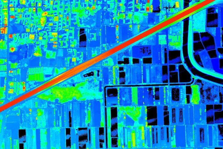
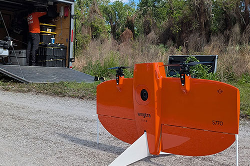
As Waynesboro evolves, the requirement for high-fidelity spatial data becomes paramount. Whether supporting new residential developments or conducting high-stakes inspections for regional energy utilities, there is no room for approximation. Fair Lifts Surveying provides the rigorous vertical and horizontal precision required for complex engineering projects. Leveraging Blue UAS platforms and advanced LiDAR sensors, we penetrate the thickest Georgia pines and timber canopy to deliver millions of accurate data points.
Our dedication to Waynesboro includes a fierce commitment to data sovereignty. In an environment where digital security is non-negotiable, we prioritize the protection of regional infrastructure information. Our Blue UAS status signifies compliance with the most stringent Department of Defense standards for supply chain safety and encryption. When we survey a Burke County substation, pipeline, or industrial site, your asset data remains secure from the moment of flight to final delivery. We deliver more than just a map; we provide clarity, protected by the highest standards of professional security.
We invite you to consult with our specialists to see how Fair Lifts is modernizing the agricultural and industrial landscape of Waynesboro, GA. Our team of agronomists, project managers, and FAA-certified pilots is ready to solve your most complex logistical hurdles. In Burke County, we don’t just navigate the future; we build it from the air.
Regional Footprint
Local Mobilization
Our regional crew is based right here, ensuring sub-24 hour deployment for Burke, Richmond, Jefferson, and Jenkins counties.
Request Local Response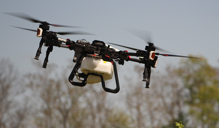
Ready to Start Your Project?
Discuss your specific goals in Waynesboro with a regional expert. We provide rapid mobilization and precision scoping for every regional client.